Conservation Values
Conservation Values of kooparoona niara (Great Western Tiers)
The original Tasmanians have had an association with the area spanning many thousands of years. The present-day aboriginal community has strong cultural links with the region, giving it the name kooparoona niara – the Mountains of the Spirits. The area is rich in globally significant Aboriginal heritage. We do not attempt to describe that heritage here and any such information would need to be provided by the Aboriginal community.
kooparoona niara (Great Western Tiers) includes the imposing northern and eastern escarpment of the extensive Central Plateau of Tasmania. This term is usually taken to include both adjoining parts of the plateau (especially the part readily accessible by day walks) and the lower slopes, which are partly forest in public ownership – with high conservation values – and partly private homes, farms and much cherished bushland. The Mole Creek karst area at the western end (parts of which already have national park status) has a distinctive underground drainage system and includes some spectacular, world-class, caves. The majority of the adjoining local community, and indeed the environmental science community, see the Tiers as a logical whole – in many different senses. Piecemeal conservation efforts, while they have achieved and may still achieve much good, may be missing the big picture.
Geology
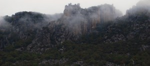
kooparoona niara (Great Western Tiers) is a whole in a geological sense – the dolerite cliffs and the slopes and benches below, progressing downwards through a series of strata (in places outcropping) to the Ordovician limestone of the Mole Creek karst. The name “Tiers” reflects the distinctive stepped profile. The rock sequence apparent in the Tiers is the visible expression of the Central Plateau itself.
Scenery
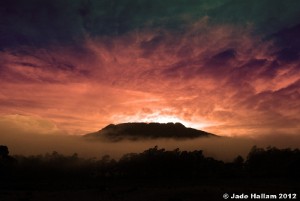
kooparoona niara (Great Western Tiers) is a whole in the scenic sense. The area is highly visible from fore, middle and background views and the visual catchment for the area is very large, being of the order of a quarter of a million hectares. kooparoona niara (Great Western Tiers) is the predominant landscape feature of Northern Tasmania. The Tiers form the major visual backdrop to towns and communities from Mole Creek in the west through Deloraine to Longford in the east. The imposing cliffline is also seen from many major tourist roads (where scenic parking spots have been set up) and from popular walking destinations such as Mt Roland and the Alum Cliffs State Reserve. And of course the recurring, spectacular – but constantly changing – views of sections of the Tiers gained from the many cliffs, bluffs and peaks are a constant delight to walkers in the region itself.
Vegetation of the Tiers
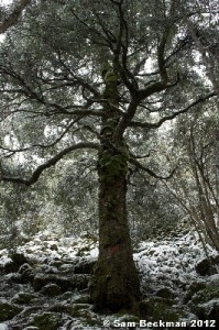
With its substantial altitudinal range, approximately 300m to 1200m over most of its length (1440m at the highest peak, Mt Ironstone), kooparoona niara (Great Western Tiers) is home to a great number of inter-grading forest communities. Several identified communities occurring here are under-reserved statewide. On topographic benches the Tiers provide for several unique relict communities. Edaphic controls (unusual soil types) preserve occurrences of forest types otherwise out of place e.g. dry sclerophyll types in a high rainfall region. Several of the deeply-incised gorges of the Tiers harbour disjunct stands (almost certainly post-glacial relics) of both Pencil Pine and King Billy Pine, and at least four gorges also contain the rare hybrid between the two, Athrotaxis laxifolia. Other complex and unique plant communities are found in sphagnum peatlands on benches at various altitudes, and others are associated with sandstone cliffs in the many places where that layer outcrops.
Fauna Habitat
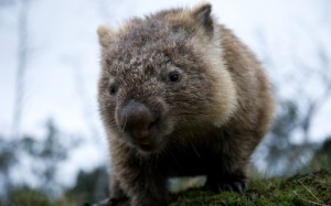
kooparoona niara (Great Western Tiers) provides suitable habitat for all 35 species of Tasmanian native mammal (and most have been recorded here, in many cases quite recently). It may be argued that kooparoona niara (Great Western Tiers) can serve as a central gene pool for all species of Tasmanian mammals. The region is presently connected to most other parts of Tasmania through habitat which is suitable for their dispersal. The bird list is also extensive, and kooparoona niara (Great Western Tiers) is a stronghold of a number of endangered species including the threatened White (Grey) Goshawk and the Tasmanian wedge-tailed eagle. There are high levels of endemism – species occurring nowhere else – especially in the case of invertebrates. A case in point is the blind, cave-adapted mountain shrimp Anaspides. The recent, beautifully illustrated, book “The Edge” by Sarah Lloyd gives a good overview of the fauna and flora of the Tiers.
Adaptation of Species to Climate Change
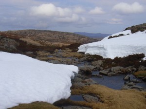
It is important in a species conservation sense that reserves not only be of adequate size and a suitable shape, but that they possess a substantial altitudinal range to allow migration of species (of plants especially, with their limited mobility) in response to climate change. In this kooparoona niara (Great Western Tiers) excels. In 1987 Professor Henry Nix, the leading expert on biological climate modelling in Australia, had this to say:
“Any reservation of species and communities that has a currently restricted climatic range must include the provision for a climatic buffer to allow movement of species and communities. This is best achieved where current climatic gradients are very steep, allowing movement up a slope, or very broad where “erosion” at the edge will not eliminate the species or community….. The slopes of the Western Tiers in the vicinity of Quamby Bluff, which is at the junction of Eastern and Western climatic regions, has refugia habitats containing species from both regions growing together (Kirkpatrick, 1986). It is likely that the Forth and Mersey valleys also contain refugia sites. In this context, the presence of low to high altitude vegetation sequences from approximately 300m-1400m in the Forth, 800m-1500m in the Mersey and 300m-1300m from Jackeys Marsh to the top of the Western Tiers escarpment, are of prime importance….. “. This was in the days when human-induced climate change was a conjecture, and in 2012 the matter can be held to be even more vital.
Catchment Protection
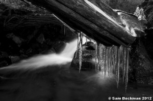
kooparoona niara (Great Western Tiers) contain a multitude of streams. Of the approximately 150 perennial streams apparent on official 1:25000 maps in the section west of Poatina Highway, about 36 flow directly off the Central Plateau, many carrying substantial flows – initially in deeply-incised gorges, then in rocky beds in lowland forest, then meandering through farmland. Other streams originate from springs or from runoff from the slopes of the escarpment. The springs are most frequent around the contacts between the major rock strata. Some areas contain a myriad of small spring fed streams running together. The water is greatly valued by local users for its high purity. There are many individual domestic take off points within and adjacent to the forest, and some even kilometres from the forest boundary. Some community supply schemes also draw from the streams, for example that at Chudleigh, and there is at least one commercial bottler of the water from the Tiers. The headwaters of these streams are as yet pristine; but those streams which flow through logged areas have often been subject to high turbidity episodes, and, in the case of young plantations, even to poison application. The preservation of high water quality is of prime importance.
Recreational Values – Walking
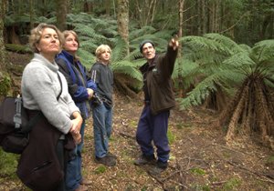
The area contains many valuable walking tracks and opportunities for untracked exploration. Many tracks rise from the populated area to “the top” and provide a varied experience for walkers as they pass the various vegetation types. The higher portions of many of these tracks offer outstanding views out over the plains to distant mountains and towns, the ocean, along the Tiers, down over the forested slopes and out to the dolerite cliffs, boulder fields and subalpine and alpine forest, scrub and heath. Many offer intimate experiences of mountain streams, streamside riparian vegetation and native conifers. Each track has its own special features.
Recreational Values – Caving
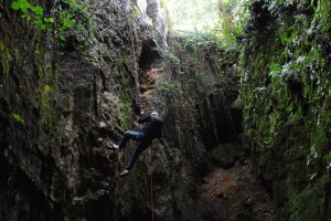
Mole Creek is one of Australia’s most important destinations for caving clubs with many interstate clubs visiting every year. Cavers value the beauty and state of activity of its cave formations (and some the photographic opportunities), the variety of cave types and exploration techniques required and the density of subsurface developments over a fairly compact and accessible area. Two of the finest caves are open for public viewing. The caves of Mole Creek, because of less recreational pressure to date, are in extraordinarily better condition than most mainland caves.
Early Documentation
Independent Verification Group Documentation
Download the summary of the 2012 findings of the Independent Verification Group as to the conservation values of the Great Western Tiers here.Further References: